
4

#30DayMapChallenge: Day 2 – Lines
source link: https://hannes.enjoys.it/blog/2019/11/30daymapchallenge-day-2-lines/
Go to the source link to view the article. You can view the picture content, updated content and better typesetting reading experience. If the link is broken, please click the button below to view the snapshot at that time.
#30DayMapChallenge: Day 2 – Lines
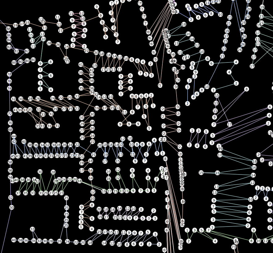
Addresses in Hamburg: http://suche.transparenz.hamburg.de/dataset/alkis-adressen-hamburg15
Convert the housenumber from string to integer: to_int("hausnr")
Processing -> Points to Path using above housenumber as order field and strname as group field.
Color those ziggyzaggety lines as you like.
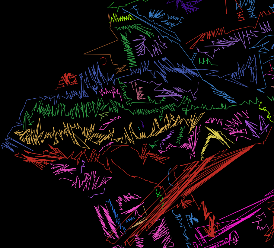

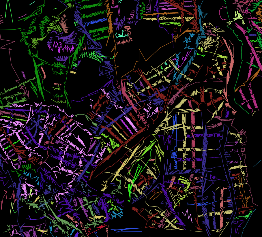
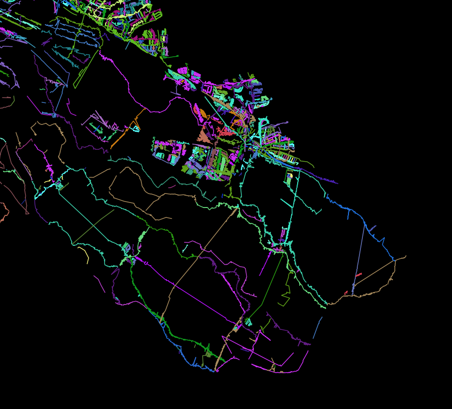
Maybe explode the lines and style each segment by its housenumber?

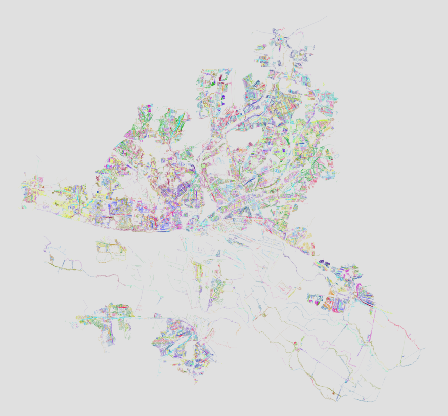
And put them on an interactive slippy map.
Post navigation
← Dynamic elevation profile lines as QGIS geometry generator #30DayMapChallenge: Day 3 – Polygons OR Lego® style brick raster in QGIS using Geometry Generator expressions →This site uses Akismet to reduce spam. Learn how your comment data is processed.
Recommend
About Joyk
Aggregate valuable and interesting links.
Joyk means Joy of geeK