

GeoCue unveils three new TrueView LiDAR systems for drones
source link: https://dronedj.com/2024/02/13/geocue-lidar-drone-mapping-trueview/
Go to the source link to view the article. You can view the picture content, updated content and better typesetting reading experience. If the link is broken, please click the button below to view the snapshot at that time.
GeoCue unveils three new TrueView LiDAR systems for drones
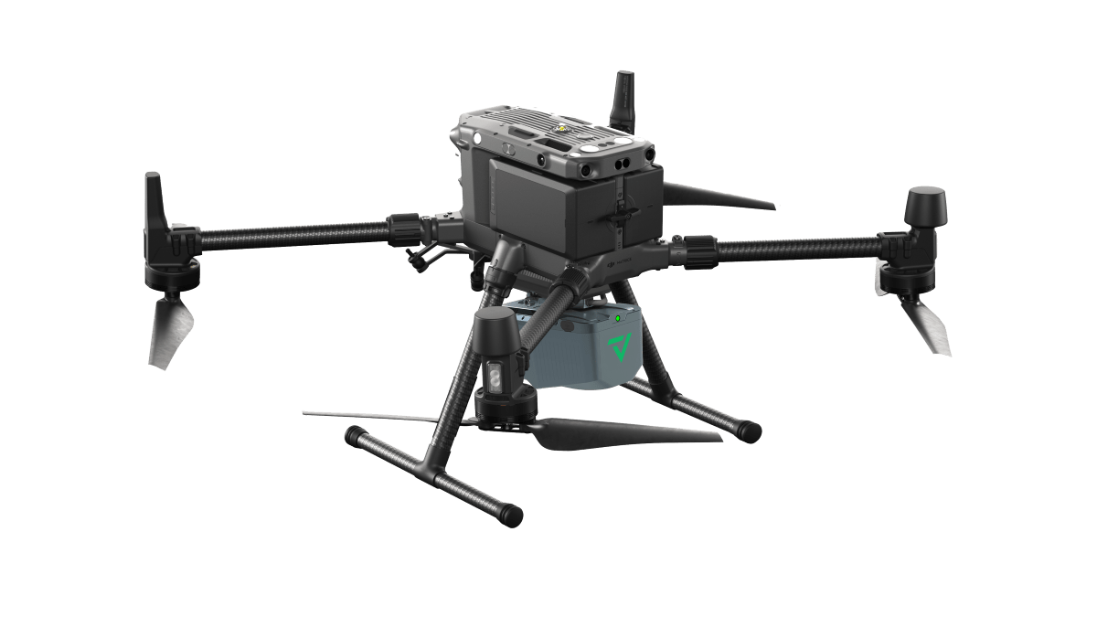
LiDAR tech specialist GeoCue has released three new survey-grade TrueView LiDAR systems for commercial drones such as the DJI M300 RTK.
GeoCue‘s new 3D imaging systems include the TrueView 540, the TrueView 545, and the TrueView 585, each catering to distinct market needs.
TrueView 540, for instance, is a mid-range sensor developed in collaboration with geomatics company CHC Navigation. It integrates high-precision LiDAR, an accurate positioning and orientation system, and a full-frame industrial camera. The solution uses GeoCue’s LP360 software for data processing.
The new TrueView 545, on the other hand, is a premium LiDAR system that builds on the success of TrueView 535 with three integrated cameras including a photogrammetry-ready 45 MP nadir camera. This product also includes unlimited access to PP-RTX eliminating the time-consuming need to set up a base station in the field.
And finally, let’s talk about TrueView 585, an affordable NDAA-compliant system. Featuring three cameras, this high-resolution, long-range survey-grade LiDAR option delivers superior object detection capabilities.
GeoCue has further announced improvements to two of its best-selling TrueView sensors. “The 515 Version C system is now upgraded with two new oblique 26 MP Cameras,” says Frank Darmayan, CEO of GeoCue. “Also, our popular 535 Version C now comes with two 26 MP oblique cameras and a third 26 MP nadir camera to improve photogrammetry deliverables. Furthermore, the optional mobile mapping capability available in the 535 further expands the utility and versatility of our offerings.”
That’s not all. GeoCue has also introduced a new pricing tier for TrueView 515 and 535 payloads. The company’s Flex pricing model offers users a chance to acquire the LiDAR payloads at an attractive price while introducing a simplified and efficient yearly subscription model for the LP360 processing software.
Vincent Legrand, global VP of sales at GeoCue, says, “Flex Pricing is more than just a pricing strategy; it’s a strategic response to industry demands. By introducing FLEX, we empower our customers with a comprehensive solution, seamlessly integrating field-proven technology and LP360 software. FLEX allows you to conserve working capital, improve cash flow, and achieve a strong Return on Investment, making it a comprehensive and forward-thinking choice for our valued customers.”
GeoCue was acquired by Germany-based Microdrones’ parent company mdGroup last year.
Read more: Drones carrying explosives to help Alaska with avalanche mitigation
FTC: We use income earning auto affiliate links. More.
Recommend
About Joyk
Aggregate valuable and interesting links.
Joyk means Joy of geeK